
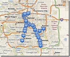
After having created custom maps (RTD Light Rail stations) in both Microsoft's Live Maps and Google's Maps solution, here are some of my thoughts:
1. On an unconnected note to this topic Microsoft has higher resolution and newer imagery for the Denver area. (link) This made it a lot more easier to map the stations in Live Maps as the stations were present in MS's imagery (the bridge across the highway is part of the station which is not there in Google's imagery). The station shown below is the Belleview station and opened sometime in October of 2006, so Microsoft's imagery must be post October 2006 and Google's must be pre October 2006.
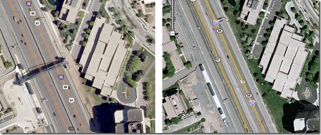
link to above comparison: http://www.jonasson.org/maps/?lat=39.61409008931873&lng=-104.89550828933717&z=18
2. In Google custom maps are called My Maps. In Live Maps they are called collections.
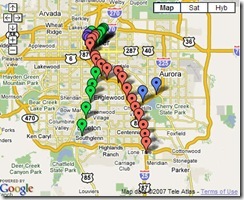
3. Even though my example has only points representing RTD Light Rail Stations, both Live maps and Google maps allow one to also create lines and polygons.
4. Both Google and Microsoft allow you to share your custom maps. Though if you see this post of mine (link), you will see that Google allows you to embed their maps, which is a great feature. Live maps on the other hand only gives you a link and does not yet create the HTML code required to embed the map in a blog. (I am sure this will change soon).
5. Another nifty feature in Google Maps is that you can change your icons - Google has a collection that you can use, or alternatively you can even use your own custom icons. This will obviously make for cooler looking maps. On the other hand - Live Maps doesn't yet allow you to change icons.
6. I love the fact that you can view your maps in Live in a variety of views. Not just the traditional satellite, road and hybrid, but also bird's eye and 3D. 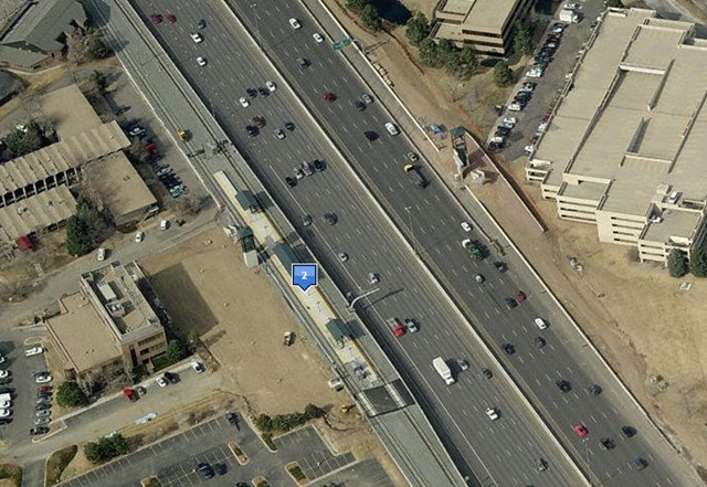 Bird's Eye View
 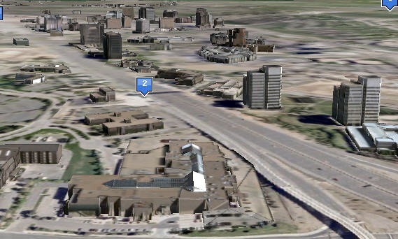 3D View - with 3D buildings.
In conclusion:
Both Google Map's and Live Map's solutions are easy to use. They each have features that make them useful in their own ways (maps that can be embedded, custom icons for Google; bird's eye and 3D views in Live Maps). The fact that Live maps had higher res and more recent imagery made it a ton easier to map the locations, but I am sure there are other cities where Google has newer and better imagery - so I don't want to include that as a factor.
So both Google Maps and Live Maps are great ways to share custom maps. But because I have higher resolution imagery in Denver, I think I will be using Live Maps. Another factor that I love is the 3D view available within the browser.
Above I have an example of a location where Live Maps has higher resolution imagery. Here is an example where Google Maps has higher resolution and newer imagery than Live Maps.
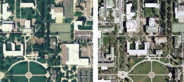
http://www.jonasson.org/maps/?lat=46.861705914112164&lng=-113.98490309715271&z=17
(On the right is Google Maps and it shows the journalism building almost complete at the University of Montana, Missoula. In Virtual Earth, the ground seems to have been broken and the image looks like it was taken in spring).
No comments:
Post a Comment